LoTIS: Learning to Localize Reference Trajectories in Image-Space for Visual Navigation
Robotics: Science and Systems (RSS), 2026
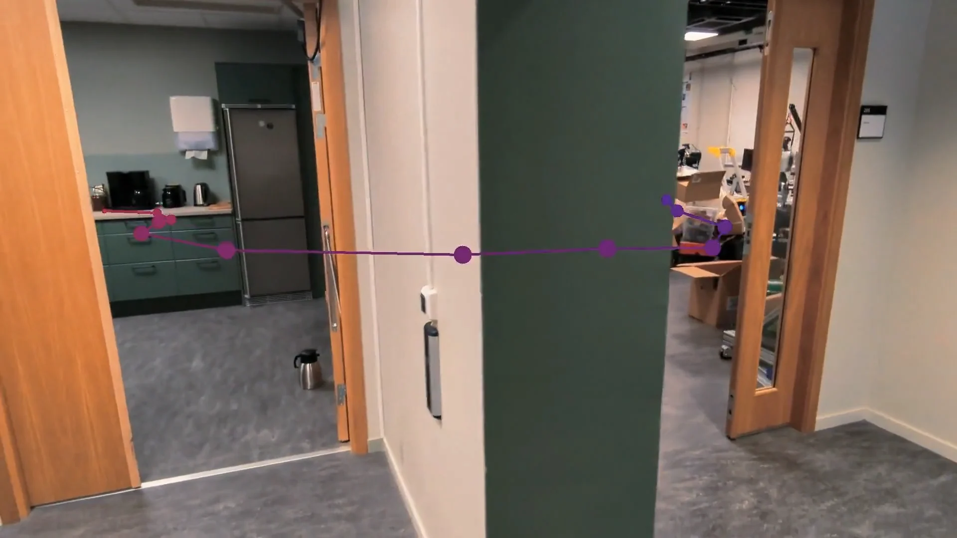
TL;DR: Given a reference video recorded with, for example, a phone, LoTIS allows a robot with an onboard RGB camera to navigate to a selected point along the recorded trajectory from a visually overlapping initial view, without robot-specific training.
Abstract
We present LoTIS, a model for visual navigation that provides robot-agnostic image-space guidance by localizing a reference RGB trajectory in the robot's current view, without requiring camera calibration, poses, or robot-specific training. Instead of predicting actions tied to specific robots, we predict the image-space coordinates of the reference trajectory as they would appear in the robot's current view. This creates robot-agnostic visual guidance that easily integrates with local planning. Consequently, our model's predictions provide guidance zero-shot across diverse embodiments. By decoupling perception from action and learning to localize reference-trajectory frames rather than imitate behavioral priors, we enable a cross-trajectory training strategy that learns robust invariance to viewpoint and camera changes. We outperform state-of-the-art methods by 20-50 percentage points in success rate on forward navigation, and paired with a local planner we achieve 94-98% success rate across diverse sim and real environments. Furthermore, we achieve over 5x improvements on challenging tasks where baselines fail, such as backward traversal. The system is straightforward to use: we show how even a video from a handheld phone camera directly enables different robots to navigate to any point on the trajectory.
Method
LoTIS encodes the full reference trajectory once offline. For every query image, lightweight online inference matches the query against the encoded trajectory, while a recurrent prediction head localizes each reference-trajectory frame as image-space coordinates, normalized distance, and visibility.
The yaw controller directly uses the predicted image-space coordinates, normalized distances, and visibility. For MPPI, the predicted image locations are first projected into 3D using estimated depth.
- Identify the closest visible frame k from LoTIS's distance predictions.
- Choose a small look-ahead k ± Δ toward the selected goal g.
- Steer to reduce its horizontal image error while moving forward.
- Depth projection maps the predicted image locations into 3D using estimated depth and camera parameters.
- MPPI scores candidate paths using collision cost and predicted-trajectory visibility.
Experiment Gallery
Reference trajectories recorded with a handheld phone. Navigation runs start from arbitrary positions with visual overlap to the reference. Experiments include backward traversal, people occlusions, and day-to-night appearance changes. Aggregate success rates and baseline comparisons are reported in the paper.
Controller used for this environment: perception-aware MPPI
Reference Trajectory
Forward Navigation
Navigate to the end of the trajectory. The robot must match visual features despite viewpoint and camera differences from the handheld reference.
Start 0
Start 1
Start 2
Start 3
Start 4
Start 5
Backward Navigation
Return to the start of the trajectory. The robot observes the environment from the opposite direction to the reference recording, making correspondence difficult for methods based on pairwise visual matching. You can explore an example of the model inferences on backward views in our demo.
Start 0
Start 1
Start 2
Start 3
Start 4
Start 5
Robustness Experiments
LoTIS continues to navigate successfully under people occlusions and day-to-night appearance changes.
Controller used for this environment: perception-aware MPPI
Using the same Indoors 2 reference trajectory (recorded without people), but now people walk through the scene during navigation, occluding the robot's view.
Forward Navigation
Start 0
Start 1
Start 2
Start 3
Start 4
Start 5
Backward Navigation
Start 0
Start 1
Start 2
Start 3
Start 4
Start 5
Long-Range Navigation
Long reference trajectories are divided into shorter chunks and processed in batches, enabling navigation over kilometer-scale trajectories without encoding the full trajectory at once.
BibTeX
@misc{busch2026learninglocalizereferencetrajectories,
  title={Learning to Localize Reference Trajectories in Image-Space for Visual Navigation},
  author={Finn Lukas Busch and Matti Vahs and Quantao Yang and Jesús Gerardo Ortega Peimbert and Yixi Cai and Jana Tumova and Olov Andersson},
  year={2026},
  eprint={2602.18803},
  archivePrefix={arXiv},
  primaryClass={cs.RO},
  url={https://arxiv.org/abs/2602.18803},
}